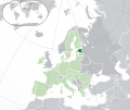
Fichier:EU-Poland.svg
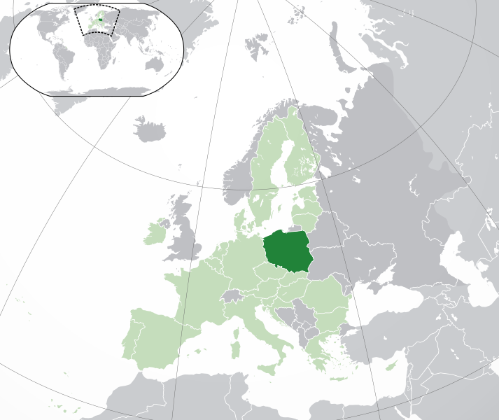
Taille de cet aperçu PNG pour ce fichier SVG : 713 × 600 pixels. Eutes résolucions : 285 × 240 pixels | 571 × 480 pixels | 913 × 768 pixels | 1 218 × 1 024 pixels | 2 435 × 2 048 pixels | 2 045 × 1 720 pixels.
Fichier d’origine (Fichié SVG, résoluchon éd 2 045 × 1 720 picsels, diminchon: 7,33 Mio)
Histoère dech fichié
Buke su eune date/heure pou vir ch'fichié conme il étoait ach momint-lo.
| Date/Tans | Tiote image | Diminsions | Uzeu | Fichié éd chés conmints | |
|---|---|---|---|---|---|
| courant | 1 ed Févrié 2020 à 05:19 |  | 2 045 × 1 720 (7,33 Mio) | Rob984 | UK and Gibraltar have left the EU. New base which includes all of Portugal's islands within frame, as well as Arctic Russian islands part of Europe. Also fixed Flevoland in the Netherlands. |
| 25 d'Octobe 2016 à 20:34 |  | 2 045 × 1 720 (7,32 Mio) | Giorgi Balakhadze | fix | |
| 24 ed Déchimbe 2015 à 09:25 |  | 2 045 × 1 720 (7,33 Mio) | Nordwestern | Per original framework and Commons' rules. Agree with A2D2. | |
| 18 ed Marche 2015 à 15:58 |  | 2 045 × 1 720 (7,38 Mio) | Mapclean | Reverted to Leftcry's version, please go to your talk page | |
| 21 ed Févrié 2015 à 14:10 |  | 2 045 × 1 720 (2,61 Mio) | VS6507 | Spain. Greece. Slovakia. Cyprus. Romania VETO | |
| 16 ed Novimbe 2014 à 19:34 |  | 2 045 × 1 720 (7,38 Mio) | Leftcry | Reverted to version as of 15:48, 6 August 2014 Please go to your talk page | |
| 16 ed Novimbe 2014 à 16:36 |  | 2 045 × 1 720 (2,61 Mio) | A2D2 | The map must show the original de-jure status with no breakaway regions, as it was originally created. An alternative map showing the de-facto status with breakaway regions needs to be created instead. | |
| 6 d'Aout 2014 à 15:48 |  | 2 045 × 1 720 (7,38 Mio) | Rob984 | Improved version: More accurate coastline, borders, etc. Added Gradient and Longitude and latitude lines. Sudan border. | |
| 1 ed Juillet 2013 à 09:31 |  | 2 045 × 1 720 (2,61 Mio) | U5K0 | croatia | |
| 23 d'Octobe 2009 à 14:41 |  | 2 045 × 1 720 (2,59 Mio) | NuclearVacuum | consensus version |
Usage dech fichié
L'pache d'apreu est loyée à ch'fichié-lo :
Usage global du fichier
Chés eutes wikis suivants uzette chole fichier :
- Utilisacion édseur ace.wikipedia.org
- Utilisacion édseur ady.wikipedia.org
- Utilisacion édseur af.wikipedia.org
- Utilisacion édseur ami.wikipedia.org
- Utilisacion édseur ar.wikipedia.org
- العلاقات البولندية السعودية
- مستخدم:ElWaliElAlaoui/ملعب 8
- معاملة المثليين في بولندا
- مستخدم:جار الله/قائمة صور مقالات العلاقات الثنائية
- العلاقات الأمريكية البولندية
- العلاقات الأنغولية البولندية
- العلاقات البولندية الكورية الجنوبية
- العلاقات الإريترية البولندية
- العلاقات البولندية السويسرية
- العلاقات البولندية الليختنشتانية
- العلاقات البولندية البوليفية
- العلاقات البولندية الموزمبيقية
- العلاقات الألبانية البولندية
- العلاقات البلجيكية البولندية
- العلاقات الإثيوبية البولندية
- العلاقات البولندية البيلاروسية
- العلاقات البولندية الطاجيكستانية
- العلاقات البولندية الروسية
- العلاقات الأرجنتينية البولندية
- العلاقات البولندية الغامبية
- العلاقات البولندية القبرصية
- العلاقات البولندية السيراليونية
- العلاقات البولندية النيبالية
- العلاقات البولندية الليبيرية
- العلاقات التشيكية البولندية
- العلاقات البولندية الميانمارية
- العلاقات البولندية الكندية
- العلاقات البولندية الزيمبابوية
- العلاقات الإسرائيلية البولندية
- العلاقات البالاوية البولندية
- العلاقات البولندية المالية
- العلاقات البولندية النيجيرية
- العلاقات اليمنية البولندية
- العلاقات البولندية الفانواتية
- العلاقات الغابونية البولندية
- العلاقات البنمية البولندية
- العلاقات البولندية الكوبية
- العلاقات البولندية الجورجية
- العلاقات البولندية التونسية
- العلاقات البولندية الكورية الشمالية
- العلاقات الهندية البولندية
- العلاقات اليابانية البولندية
- العلاقات الإيطالية البولندية
- العلاقات البولندية الناوروية
- العلاقات الأسترالية البولندية
- العلاقات البولندية الزامبية
Vir davantage édseur l’utilisacion globale éd chole fichié-lo.


