
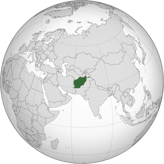
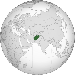
Fichier:Afghanistan (orthographic projection).svg

Taille de cet aperçu PNG pour ce fichier SVG : 553 × 553 pixels. Eutes résolucions : 240 × 240 pixels | 480 × 480 pixels | 768 × 768 pixels | 1 024 × 1 024 pixels | 2 048 × 2 048 pixels.
Fichier d’origine (Fichié SVG, résoluchon éd 553 × 553 picsels, diminchon: 298 kio)
.svg)
Résumè
| Décripchon |
اردو: طرحی متعامد از افغانستان |
| Date | |
| Source | Travail personnel basé sur : India (orthographic projection).svg de Ssolbergj |
| Auteu | Shahid Parvez |
| SVG information |
.svg)
Licince
Cette carte a été créée avec le Generic Mapping Tools : https://www.generic-mapping-tools.org/ utilisant pour le relief un ou plusieurs de ces jeux de données du domaine public :
|

|
Os avez l' pérmission d' copier, distribuer pi modifier chol documint slon chés térmes del GNU Free Documentation License vérsion 1.2 obin toute vérsion ultérieure publièe pèr el Free Software Foundation, sans sékcions inaltérabes, sans teske d' prumière pache d' couvérture pi sans teske ed darène pache d' couvérture. Un egzimploère del licince est inclus dins l' sékcion intitulée GNU Free Documentation License. |
Journal des téléversements d’origine
Transféré de en.wikipedia à Commons par Cirt utilisant CommonsHelper.
La page de description originale était ici. Tous les noms d'utilisateur qui suivent se rapportent à en.wikipedia.
- 2009-10-05 17:28 Parvez gsm 541×541× (517730 bytes) {{Information |Description = Afghanistan orthographic_projection |Source = I have created this work entirely by myself. |Date = October 5 |Author = Shahid Parvez |other_versions = }}
Histoère dech fichié
Buke su eune date/heure pou vir ch'fichié conme il étoait ach momint-lo.
| Date/Tans | Tiote image | Diminsions | Uzeu | Fichié éd chés conmints | |
|---|---|---|---|---|---|
| courant | 27 ed Juillet 2019 à 14:46 | | 553 × 553 (298 kio) | Cerebellum | Revert to prior version, please provide a source for those territorial claims |
| 26 ed Juillet 2019 à 10:29 |  | 720 × 720 (384 kio) | Lakshmisreekanth | Updated color | |
| 25 ed Juillet 2019 à 17:00 |  | 720 × 727 (397 kio) | Lakshmisreekanth | Added claimed regions | |
| 16 ed Marche 2015 à 23:36 |  | 553 × 553 (298 kio) | Flappiefh | Removed Somaliland and Kosovo. Separated Western Sahara and Morroco. | |
| 4 d'Aout 2013 à 12:43 |  | 553 × 553 (302 kio) | Flappiefh | Added South Sudan. The map is now centered on Afghanistan. | |
| 20 ed Novimbe 2009 à 22:45 |  | 541 × 541 (506 kio) | File Upload Bot (Magnus Manske) | {{BotMoveToCommons|en.wikipedia|year={{subst:CURRENTYEAR}}|month={{subst:CURRENTMONTHNAME}}|day={{subst:CURRENTDAY}}}} {{Information |Description={{en|Afghanistan orthographic_projection}} |Source=Transferred from [http://en.wikipedia.org en.wikipedia]; |
Usage dech fichié
L'pache d'apreu est loyée à ch'fichié-lo :
Usage global du fichier
Chés eutes wikis suivants uzette chole fichier :
- Utilisacion édseur ady.wikipedia.org
- Utilisacion édseur af.wikipedia.org
- Utilisacion édseur ami.wikipedia.org
- Utilisacion édseur arc.wikipedia.org
- Utilisacion édseur ar.wikipedia.org
- Utilisacion édseur arz.wikipedia.org
- Utilisacion édseur ast.wikipedia.org
- Utilisacion édseur as.wikipedia.org
- Utilisacion édseur av.wikipedia.org
- Utilisacion édseur awa.wikipedia.org
- Utilisacion édseur azb.wikipedia.org
- Utilisacion édseur az.wikipedia.org
- Utilisacion édseur az.wiktionary.org
- Utilisacion édseur ba.wikipedia.org
- Utilisacion édseur bbc.wikipedia.org
- Utilisacion édseur be-tarask.wikipedia.org
- Utilisacion édseur be.wikipedia.org
- Utilisacion édseur bg.wikipedia.org
- Utilisacion édseur bh.wikipedia.org
- Utilisacion édseur bi.wikipedia.org
- Utilisacion édseur bn.wikipedia.org
- Utilisacion édseur bn.wikivoyage.org
- Utilisacion édseur br.wikipedia.org
- Utilisacion édseur ca.wikipedia.org
Vir davantage édseur l’utilisacion globale éd chole fichié-lo.
.svg)
.svg)