
Fichier:Georgia (orthographic projection).svg

Taille de cet aperçu PNG pour ce fichier SVG : 553 × 553 pixels. Eutes résolucions : 240 × 240 pixels | 480 × 480 pixels | 768 × 768 pixels | 1 024 × 1 024 pixels | 2 048 × 2 048 pixels.
Fichier d’origine (Fichié SVG, résoluchon éd 553 × 553 picsels, diminchon: 302 kio)
Résumè
| Décripchon |
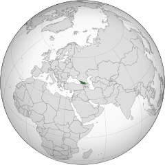
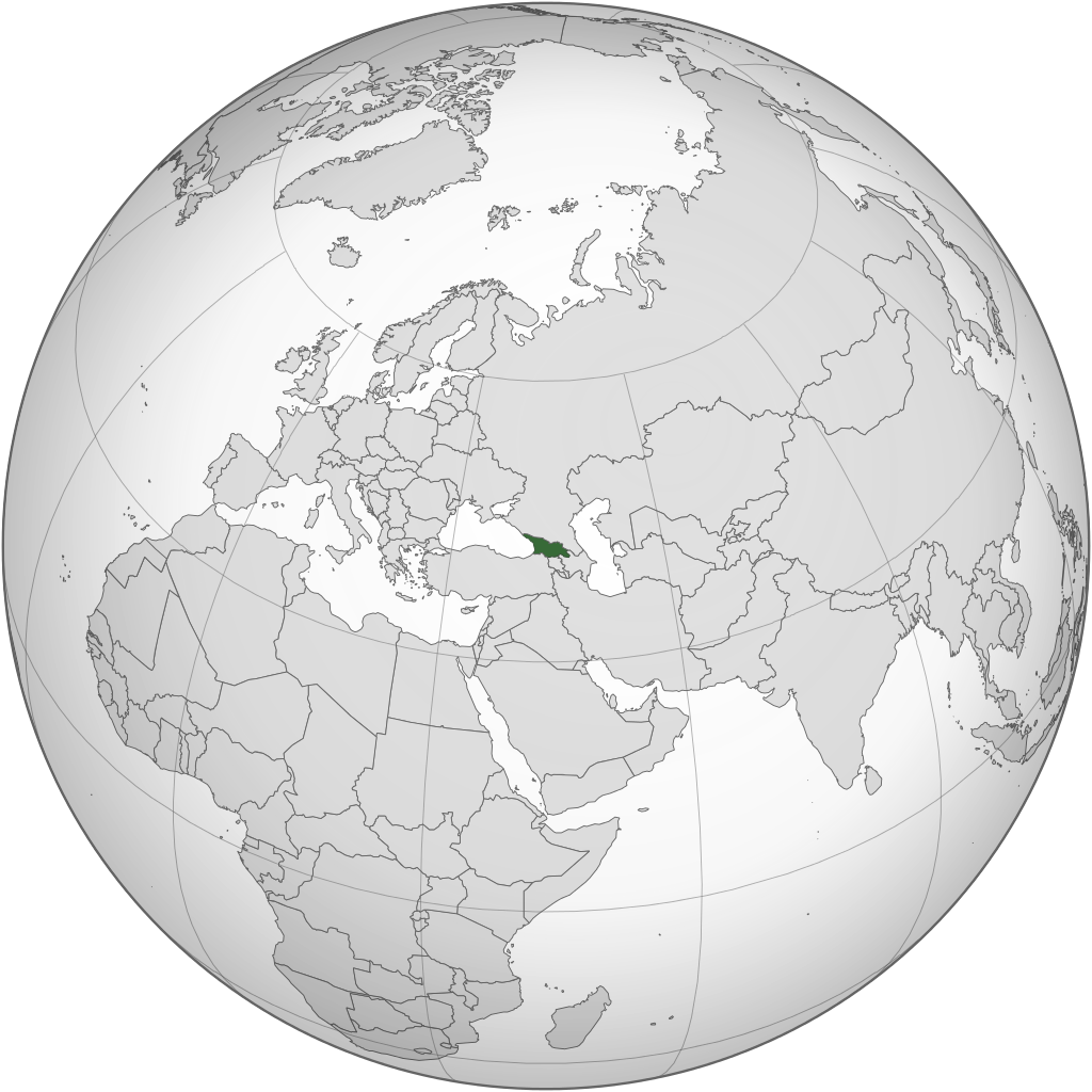
English: Location of Georgia.
.svg) |
| Date | |
| Source | Traval parsonnel |
| Auteu | Izzedine |
| Autres versions |
.svg) .svg) |
| SVG information |
.svg)
.svg)
.svg)
.svg)
.svg)
.svg)
.svg)
.svg)
.svg)
.svg)
.svg)
.svg)
.svg)
.svg)
.svg)
.svg)
.svg)
.svg)
.svg)
.svg)
.svg)
.svg)
.svg)
.svg)
.svg)
.svg)
.svg)
.svg)
.svg)
.svg)
.svg)
.svg)
.svg)
.svg)
.svg)
.svg)
.svg)
.svg)
.svg)
.svg)
.svg)
.svg)
.svg)
.svg)
.svg)
.svg)
.svg)
.svg)
.svg)
.svg)
.svg)
.svg)
.svg)
.svg)
.svg)
.svg)
.svg)
.svg)
.svg)
.svg)
.svg)
.svg)
.svg)
.svg)
.svg)
.svg)
.svg)
.svg)
.svg)
.svg)
.svg)
.svg)
.svg)

.svg)

.svg)

.svg)
.svg)
.svg)
.svg)
.svg)
.svg)
.svg)


.svg)
.svg)
.svg)
.svg)
.svg)
.svg)
.svg)

.svg)
.svg)
.svg)
.svg)
.svg)
.svg)
.svg)
.svg)
.svg)
.svg)

.svg)
.svg)
.svg)
.svg)
.svg)
.svg)
.svg)
_without_national_boundaries.svg)
.svg)
.svg)
.svg)
.svg)
.svg)
.svg)

.svg)
.svg)
.png)
.svg)
.svg)

.svg)
.svg)
.svg)
.svg)
.svg)
.svg)
.svg)
.svg)
.svg)
.svg)
.svg)

.svg)
.svg)
.svg)
.svg)
.svg)
.svg)
.svg)
.svg)
.svg)

.svg)
.svg)

.svg)
.svg)
.svg)
.svg)
.svg)
.svg)
.svg)
.svg)
.svg)
.svg)
.svg)
.svg)
.svg)
.svg)
.svg)
.svg)
.svg)
.svg)
.svg)
.svg)
.svg)
.svg)
.svg)
.svg)
.svg)
.svg)
.svg)
_-_Crimea_disputed.svg)
.svg)
.svg)
.svg)
.svg)
.svg)
.svg)
.svg)
.svg)
.svg)
.svg)
.svg)
_political.svg)
.svg)
.svg)
.svg)
.svg)
_-_Crimea_disputed_-_no_borders.svg)
.svg)
.svg)
.svg)
.svg)
.svg)
.svg)
.svg)
.svg)
.svg)
.svg)
.svg)

.svg)
.svg)
.svg)

.png)
.svg)
.svg)
.svg)
.svg)
.svg)
.svg)
.svg)
.svg)
.svg)
.svg)
.svg)
.svg)
.svg)
.svg)
.svg)
.svg)
.svg)
.svg)
.svg)
.svg)
.svg)
.svg)
.svg)
.svg)
.svg)
.svg)
.svg)
.svg)
.svg)
.svg)
.svg)
.svg)
.svg)
.svg)
.png)
.svg)
.svg)
.svg)
_(orthographic_projection).png)
.svg)
Licince
Moi, en tant que détenteur des droits d’auteur sur cette œuvre, je la publie sous la licence suivante :
Ech fichié-lo il est disponibe slon chés térmes del licince Creative Commons Attribucion - Partage dins chés meumes Conditions 3.0 (poin transposée).
- Os ètes libe :
- éd partager – éd copier, distribuer pi transmète chole euve
- d’adapter – éd modifier chole euve
- Dsous chés condicions suivantes :
- patérnitè – Os d'vez donner chés informacions appropriées concernant l'auteu, fournir un loyen vers el licince, et indiquer si des modificacions ont tè foaites. Os povez foaire cha pèr tout moéyin raisonnabe, mais poin d'eune manière qui suggérerait qu’il vos soutienne o approuve l'utilisacion éq vos in foaites.
- partage à l’idintique – Si os modifiez, transformez, o os basez édseur chole euve, os d'vez distribuer vote contérbuchon dsous el meume licince o eune licince compatibe aveuc chole éd l'original.
Histoère dech fichié
Buke su eune date/heure pou vir ch'fichié conme il étoait ach momint-lo.
.svg&dir=prev)
.svg&offset=20110417101642)
.svg&offset=&limit=20)
.svg&offset=&limit=50)
.svg&offset=&limit=100)
.svg&offset=&limit=250)
.svg&offset=&limit=500)
| Date/Tans | Tiote image | Diminsions | Uzeu | Fichié éd chés conmints | |
|---|---|---|---|---|---|
| courant | 18 ed Marche 2015 à 22:12 | | 553 × 553 (302 kio) | Flappiefh | Added Western Sahara, fixed Somalia and removed Kosovo. |
| 4 d'Aout 2013 à 12:19 |  | 553 × 553 (307 kio) | Flappiefh | Added South Sudan. | |
| 12 ed Sétimbe 2012 à 21:37 |  | 550 × 550 (437 kio) | Palosirkka | Scrubbed with http://codedread.com/scour/ | |
| 13 ed Moai 2011 à 02:15 |  | 550 × 550 (562 kio) | Geagea | Reverted to version as of 00:04, 8 January 2011. Original file. | |
| 12 ed Moai 2011 à 22:27 |  | 550 × 550 (773 kio) | Shibo77 | Reverted to version as of 05:49, 27 April 2011 sockpuppet | |
| 3 ed Moai 2011 à 07:08 |  | 550 × 550 (562 kio) | Pols~commonswiki | Avoid overwriting existing files | |
| 27 d'Avri 2011 à 05:49 |  | 550 × 550 (773 kio) | Shibo77 | Reverted to version as of 10:58, 17 April 2011 (reverting sockpuppet's reversion) | |
| 17 d'Avri 2011 à 17:57 |  | 550 × 550 (562 kio) | Sigismun | I have been yelled at that we are not allowed to rewrite existing maps. So why not create a separate file? | |
| 17 d'Avri 2011 à 10:58 |  | 550 × 550 (773 kio) | Night w | {{Information |Description ={{en|1=Locator map of Georgia}} |Source =Own work |Author =Night w |Date = |Permission = |other_versions = }} match up boxes, reduce lineage | |
| 17 d'Avri 2011 à 10:16 |  | 550 × 550 (782 kio) | Night w | try this? |
Usage dech fichié
Autchune pache n'est loïée aveuc ch'fichié-lo
Usage global du fichier
Chés eutes wikis suivants uzette chole fichier :
- Utilisacion édseur af.wikipedia.org
- Utilisacion édseur avk.wikipedia.org
- Utilisacion édseur az.wiktionary.org
- Utilisacion édseur en.wikipedia.org
- Utilisacion édseur es.wikipedia.org
- Utilisacion édseur fi.wikipedia.org
- Utilisacion édseur fr.wikinews.org
- Utilisacion édseur gv.wikipedia.org
- Utilisacion édseur pap.wikipedia.org
- Utilisacion édseur pl.wiktionary.org
- Utilisacion édseur ru.wikinews.org
- Utilisacion édseur sa.wikipedia.org
- Utilisacion édseur uk.wikipedia.org
- Utilisacion édseur uk.wikinews.org
- Utilisacion édseur zh-classical.wikipedia.org
- Utilisacion édseur zh.wikipedia.org
.svg)