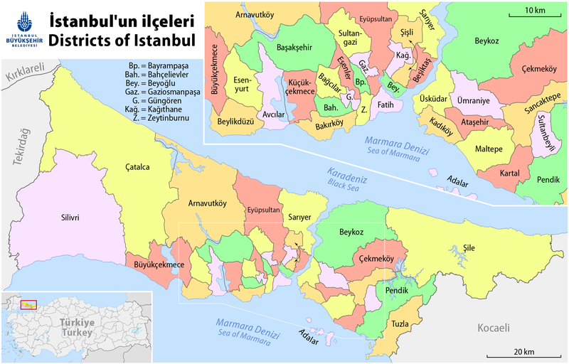
Fichier:Map of the Districts of Istanbul.png

Taille éd chl' apérchu : 800 × 512 pixels. Eutes résolucions : 320 × 205 pixels | 640 × 410 pixels | 1 024 × 656 pixels | 1 280 × 820 pixels | 2 177 × 1 394 pixels.
Fichier d’origine (2 177 × 1 394 picséls, diminchon dech fichié: 592 kio, MIME tipe: image/png)
Histoère dech fichié
Buke su eune date/heure pou vir ch'fichié conme il étoait ach momint-lo.
| Date/Tans | Tiote image | Diminsions | Uzeu | Fichié éd chés conmints | |
|---|---|---|---|---|---|
| courant | 31 ed Moai 2020 à 22:17 |  | 2 177 × 1 394 (592 kio) | Kurmanbek | Update new emblem and Eyüp > Eyüpsultan |
| 6 d'Avri 2018 à 20:53 |  | 2 177 × 1 394 (567 kio) | Chumwa | added lakes | |
| 9 d'Octobe 2012 à 17:43 |  | 2 177 × 1 394 (531 kio) | Chumwa | corr | |
| 28 ed Sétimbe 2012 à 05:16 |  | 2 177 × 1 394 (523 kio) | Chumwa | added orientation map | |
| 27 ed Sétimbe 2012 à 20:09 |  | 2 177 × 1 394 (458 kio) | Chumwa | {{Information |Description= *{{ tr }} İstanbul'un ilçeleri *{{ de }} Stadtteile von Istanbul *{{ en }} Districts of Istanbul *{{ fr }} Districts d'Istanbul |Source={own}, using this base map and [[:de:Ibb_emblem.s... |
Usage dech fichié
L'pache d'apreu est loyée à ch'fichié-lo :
Usage global du fichier
Chés eutes wikis suivants uzette chole fichier :
- Utilisacion édseur ar.wikipedia.org
- Utilisacion édseur ast.wikipedia.org
- Utilisacion édseur az.wikipedia.org
- Utilisacion édseur ba.wikipedia.org
- Utilisacion édseur be-tarask.wikipedia.org
- Utilisacion édseur be.wikipedia.org
- Utilisacion édseur bs.wikipedia.org
- Utilisacion édseur ca.wikipedia.org
- Utilisacion édseur ceb.wikipedia.org
- Utilisacion édseur cs.wikipedia.org
- Utilisacion édseur cu.wikipedia.org
- Utilisacion édseur cv.wikipedia.org
- Utilisacion édseur de.wikipedia.org
- Istanbul
- Üsküdar
- Liste der Stadtteile von Istanbul
- Beyoğlu
- Silivri
- Istanbul (Provinz)
- Şile
- Kadıköy
- Bevölkerungsentwicklung von Istanbul
- Çatalca
- Benutzer:Chumwa
- Bahçelievler
- Güngören
- Zeytinburnu
- Küçükçekmece
- Bakırköy
- Esenyurt
- Büyükçekmece
- Vorlage:Navigationsleiste Landkreise der Provinz Istanbul
- Prinzeninseln (Istanbul)
- Ataşehir
- Avcılar
- Bağcılar
- Fatih (Istanbul)
- Başakşehir
- Bayrampaşa
- Beşiktaş
- Beykoz
- Beylikdüzü
- Çekmeköy
- Esenler
- Eyüpsultan
- Gaziosmanpaşa
- Kağıthane
- Kartal (Istanbul)
Vir davantage édseur l’utilisacion globale éd chole fichié-lo.


