
Fichier:United Kingdom relief location map.jpg

Taille éd chl' apérchu : 388 × 600 pixels. Eutes résolucions : 155 × 240 pixels | 310 × 480 pixels | 497 × 768 pixels | 662 × 1 024 pixels | 1 348 × 2 083 pixels.
Fichier d’origine (1 348 × 2 083 picséls, diminchon dech fichié: 831 kio, MIME tipe: image/jpeg)
Du
Résumè
| Décripchon |
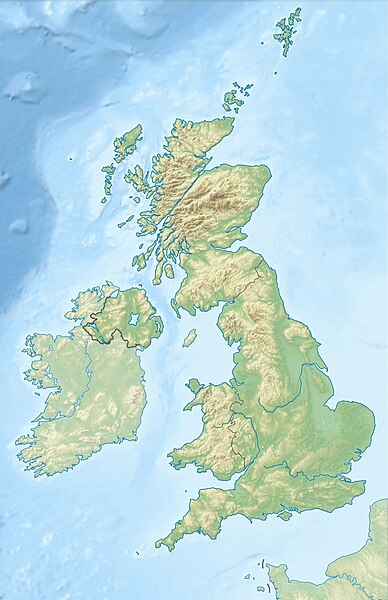
Deutsch: Positionskarte des Vereinigten Königreichs
Quadratische Plattkarte, N-S-Streckung 170 %. Geographische Begrenzung der Karte:
English: Location map of the United Kingdom
Equirectangular projection, N/S stretching 170 %. Geographic limits of the map:
|
| Date | |
| Source |
own work, using SRTM Data, |
| Auteu | Alexrk2 |
| Autres versions |
|


|
Cette carte a été créée ou améliorée dans le Kartenwerkstatt (Atelier cartographique allemand). Vous pouvez également y proposer des cartes à améliorer.
|
ПРИВЕТ ВСЕМ
Licince
Moi, en tant que détenteur des droits d’auteur sur cette œuvre, je la publie sous les licences suivantes :

|
Os avez l' pérmission d' copier, distribuer pi modifier chol documint slon chés térmes del GNU Free Documentation License vérsion 1.2 obin toute vérsion ultérieure publièe pèr el Free Software Foundation, sans sékcions inaltérabes, sans teske d' prumière pache d' couvérture pi sans teske ed darène pache d' couvérture. Un egzimploère del licince est inclus dins l' sékcion intitulée GNU Free Documentation License. |
Ech fichié-lo il est disponibe slon chés térmes del licince Creative Commons Attribucion - Partage dins chés meumes Conditions 3.0 (poin transposée).
- Os ètes libe :
- éd partager – éd copier, distribuer pi transmète chole euve
- d’adapter – éd modifier chole euve
- Dsous chés condicions suivantes :
- patérnitè – Os d'vez donner chés informacions appropriées concernant l'auteu, fournir un loyen vers el licince, et indiquer si des modificacions ont tè foaites. Os povez foaire cha pèr tout moéyin raisonnabe, mais poin d'eune manière qui suggérerait qu’il vos soutienne o approuve l'utilisacion éq vos in foaites.
- partage à l’idintique – Si os modifiez, transformez, o os basez édseur chole euve, os d'vez distribuer vote contérbuchon dsous el meume licince o eune licince compatibe aveuc chole éd l'original.
Vous pouvez choisir l’une de ces licences.
Histoère dech fichié
Buke su eune date/heure pou vir ch'fichié conme il étoait ach momint-lo.
| Date/Tans | Tiote image | Diminsions | Uzeu | Fichié éd chés conmints | |
|---|---|---|---|---|---|
| courant | 17 ed Join 2012 à 18:13 | | 1 348 × 2 083 (831 kio) | Alexrk2 | inland water |
| 17 ed Join 2012 à 18:12 |  | 1 354 × 2 090 (829 kio) | Alexrk2 | == {{int:filedesc}} == {{Information |Description= {{de|Positionskarte des Vereinigten Königreichs}} Quadratische Plattkarte, N-S-Streckung 170 %. Geographische Begrenzung der Karte: * N: 61.0° N * S: 49.0° N * W: 11.... |
Usage dech fichié
L'pache d'apreu est loyée à ch'fichié-lo :
Usage global du fichier
Chés eutes wikis suivants uzette chole fichier :
- Utilisacion édseur ab.wikipedia.org
- Utilisacion édseur ar.wikipedia.org
- Utilisacion édseur arz.wikipedia.org
- Utilisacion édseur ast.wikipedia.org
- Utilisacion édseur azb.wikipedia.org
- Utilisacion édseur az.wikipedia.org
- Şablon:Yer xəritəsi Böyük Britaniya
- İrland dənizi
- Ben Nevis
- Pa-de-Kale boğazı
- Şimal boğazı
- Orkney adaları
- Lox Ness
- Arran (ada)
- Fer adası
- Qrampian dağları
- Flanan adaları
- Finqal mağarası
- Hebrid dənizi
- Kelt dənizi
- Menay boğazı
- Nort-Minç boğazı
- Pentlənd-Ferd boğazı
- Yell boğazı
- Lya-Kupe bərzəxi
- Böyük Britaniya (ada)
- Solent
- Leskov adası
- Kernqorms Milli Parkı
- Kembri dağları
- Llin yarımadası
- Ardnamerxan
- Kintayr yarımadası
- Qrinviç yarımadası
- Qauer yarımadası
- Lends End
- Trevos burnu
- Müqəddəs Yekaterina burnu
- Lizard burnu
- Ayona
Vir davantage édseur l’utilisacion globale éd chole fichié-lo.